
Walk a St. Charles Street
Use the address as the common thread, not as a guarantee that every system will recognize it the same way. The St. Charles County Assessor property database is the practical first stop because it searches by address, street, parcel, city, ZIP, and property characteristics. Its public form does not offer an owner-name field. A returned parcel may supply ownership and mailing information, but the county says assessment data is for assessment purposes, not ownership verification or transfer.
- Enter the full address or the street name in the Assessor database, adding the city or ZIP when a street name is broad. Save the account number, parcel ID, situs address, and legal-description clues.
- Open the same place in the county public GIS map. Use the search bar, click the parcel, and use Identify or Advanced Identify to compare parcel boundaries, road frontage, and address context.
- Use the parcel owner or legal description to search the Recorder of Deeds land-record route. The recorded instrument, rather than the assessor card, is the trail for a transfer question.
- For a current registration question, use Missouri's exact-input voter confirmation or request the permitted public voter-file material from the Election Authority. There is no unrestricted public web tool for browsing every voter on a street.
- Check City permit activity by service address, then consult reverse directories for historical occupants. Preserve each result as a dated observation, because ownership, mailing, and household evidence are not interchangeable.
That order keeps the St. Charles street directory process grounded in records that are actually keyed to an address. It also prevents a common error: treating a tax-mailing address, a map label, or a recorded name as a current household list.
Search St. Charles Street Fields
The Assessor form is useful for a street-by-street pass because it pairs address inputs with parcel and physical-property filters. Begin broadly with the visible “Address or Street Name” field. Then reduce the result set with city, ZIP, subdivision, parcel ID, or a dated sale filter. Do not try to reverse the workflow by entering a person’s name: the public form inspected for St. Charles exposes no owner-name search. For title questions, move from the parcel card to the Recorder.
| Assessor field | Input | Documented use or format |
|---|---|---|
| Account | Text | Account identifier; format not stated. |
| Address or Street Name | Text | Full address or partial street-name search. |
| City | Dropdown | City list; complete choices were not exposed. |
| ZIP | Dropdown | ZIP list; complete choices were not exposed. |
| School District | Dropdown | District filter. |
| Subdivision | Text | Subdivision text search. |
| Comparable Nbhd Code | Dropdown | Neighborhood-code filter. |
| Property Type | Dropdown | Option list not exposed. |
| Residential Architecture Type | Dropdown | Option list not exposed. |
| Commercial Building Type | Dropdown | Option list not exposed. |
| Sq. Footage | Two dropdowns | Minimum-to-maximum range. |
| Beds, Baths, Half | Dropdowns | Physical-characteristic filters. |
| Year Built | Two text inputs | “No Min” through “No Max.” |
| Last Sale Date | Two text inputs | YYYY-MM-DD date range. |
| Only Qualified Sales | Checkbox | Sales filter. |
| Parcel ID | Segmented text inputs | Hyphenated structure with a final segment after a dot. |
| Clear Form and Search | Buttons | Visible reset and submission controls. |
Certified values appear on the 2026 interface, while the exact online history and sale-card cutoff were not located. A street directory search should record that limitation instead of assuming the screen holds every earlier parcel event.
Read St. Charles Parcel Details
A parcel is the land unit used by the county systems. The situs address identifies where the property sits. A mailing address is where assessment correspondence goes and may be elsewhere. A plat maps a subdivision's lots, lines, and dimensions. A criss-cross directory is an address-to-occupant listing rather than a title record. These terms make a St. Charles street directory result easier to compare without turning a single field into more proof than it offers.
- Parcel ID
- A county identifier that can bridge an address search, GIS record, and assessment card when street wording changes.
- Legal description
- The lot, block, subdivision, or metes-and-bounds description carried in recorded land documents. It is often steadier than a modern street number.
- Situs address
- The physical location of the parcel, distinct from correspondence information on an assessment record.
- Criss-cross directory
- A historical section organized by address or street that can point to an occupant for its stated year.
When the address search fails, compare the parcel, subdivision, lot or block information with the GIS and the recorded description. A lot copy can show lot number, property lines, and dimensions, but it does not show structures.
Browse St. Charles Street Maps
The county GIS Mapping and Zoning gateway gives the St. Charles street directory its spatial context. The live map supports address search, parcels, zoning, distances, voting districts, and aerial imagery.
Use Identify or Advanced Identify to document a street segment: find the address, click the parcel, inspect its attributes, and save a map link or export with the access date. The Address Information service includes address points, roads, buildings, sales, land use, and parcel area.
St. Charles Street Record Sources
Address-keyed records answer separate pieces of the question. The table keeps the difference clear. It is especially important on a street directory search, where property ownership, voter registration, permit activity, and a historical directory entry may all point to different dates or people.
| Address record | Keeper | What it can show | Access route |
|---|---|---|---|
| Assessor property search | County Assessor | Account or parcel, situs, possible owner or mailing details, values, and characteristics | Public street, address, ZIP, and parcel filters; no exposed owner-name search |
| GIS parcels and tax layers | County GIS | Parcel geometry, roads, sales or building context, tax or situs labels, and districts | Public map with identify, select, export, and measure controls |
| Recorded deeds and plats | Recorder of Deeds | Parties, instrument date, legal description, lot or block, and transfer chain | Free in-office research; Tapestry charges may apply per search; Laredo is subscription-based; prints are $1 per page |
| Voter-file material | Election Authority and Missouri | Statutory public name, year, address, district, and party fields, subject to limits | Exact lookup or scoped request, not an unrestricted street browse |
| City permits | Building Division and Tyler portal | Permit type, number, service address, and activity clues | Public service-address search; historical cutoff not located |
| Directories and maps | Library and Historical Society | Historic address or occupant clues, street files, structures, and block context | Listed microfilm, archive, and map collections |
Record the source URL and search date beside every finding. Parcel systems can change, and an address result can be updated without preserving the state of the screen that was first viewed.
Trace St. Charles Street Deeds
Once a street directory search identifies the parcel, deeds replace assumption with a recorded instrument trail. The Recorder maintains deeds, mortgages and related instruments, liens, plats, marriage records, and military discharges with special access limits. Search first by the current owner as grantee, then read the purchase instrument for the earlier party, recording date, instrument number, and legal description. Search that seller as a grantee to locate the earlier acquisition, always matching the land description rather than relying on a street number alone.
The county offers Tapestry for online index research that may charge per search and Laredo for subscription research. The office provides free research in person, with $1 paper prints. Its 201 N. Second Street research area closes at 4:30, while office hours are 8:00 to 5:00 and the service window closes at 4:50. Walk-in, mail, and e-recording channels are described by the county. The official land-record page does not state when online indexing begins or what years have images, so do not infer an online cutoff.
The Recorder's Tapestry entry point is an online route into the index.
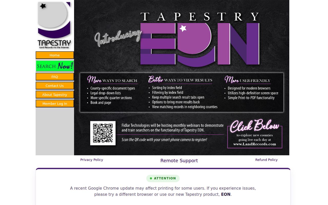
Use the image route alongside the free office option when a street address must be converted to a recorded legal description.
Find St. Charles Permit Activity
City permit activity is another address-based clue, though it is not a roster of people. The public Tyler portal accepts a service address, a permit number, or a permit-type selection. A result can help place construction or inspection activity in time, while the live issued-permit fields were not captured in the research. The official sources do not state the historic online permit cutoff.
| City permit search field | Input | Documented note |
|---|---|---|
| Permit Type | Dropdown | Optional; Tyler loads the choices, but the complete list was not exposed. |
| Permit Number | Text | Optional; portal format was not stated. |
| Service Address | Text | Optional address-keyed search; a second address control appears without a confirmed label. |
| Search or submit | Button | Control exists; accessible capture did not expose its label. |
Open the City permit-activity search before comparing service-address results with parcel and deed records.
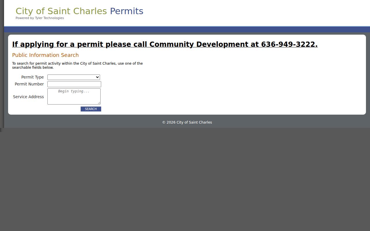
The service-address field makes this a useful supporting source when the same St. Charles street appears in current parcel research.
Request St. Charles Voter Data
Missouri's voter confirmation form is for checking a registration with exact first name, last name, date of birth, last four Social Security digits, and county. It is not an online street directory. For public voter-file material, the St. Charles County Election Authority asks requesters to email identity and contact information, choose countywide or political-subdivision scope, and state that email delivery is requested. Missouri law limits the public release set and bars commercial use under the governing voter-record structure.
Public fields can include name, year of birth, address, township or ward, precinct, and party information in the situations the statutes identify. Full birth date, Social Security information, ballot choices, and protected-address details are not open for an address browse. Voter history records participation, not candidates or ballot selections, and can be forwarded after an election. A court may close certain residential addresses, and Safe at Home participants use a designated address.
Note: A nonmatch in the exact-input confirmation form only means that the supplied registration details did not produce a match.
St. Charles Street Address Geography
St. Charles is both an incorporated city and the county seat within a larger county geography. Mailing ZIPs, municipal lines, parcel layers, and service addresses do not always describe the same boundary. The four captured St. Charles ZIPs are 63301, 63302, 63303, and 63304, but a ZIP is a delivery geography rather than a city limit. The county GIS ZIP polygon and a parcel's legal description are better checks than a mailing-city label when a street result seems inconsistent.
Older directories and deeds can also use a different street abbreviation or spelling. No official St. Charles street-renumbering or renaming schedule was located. When an old number does not resolve, compare its street text with the parcel ID, plat, GIS road layer, and recorded legal description, then leave any suspected change as an unresolved question rather than assigning it a date.
Use St. Charles Reverse Directories
Reverse or criss-cross directories are the historical address-to-occupant layer for a street directory search. Official holdings list St. Charles microfilm for 1906, 1934, 1936, 1948, 1950, 1952, 1955, 1957, and 1959. Those are discrete years, not a continuous run. Search the address section for the number and street spelling, capture the printed year and page, then test nearby available years rather than filling the gaps with an assumed move date.
The library's genealogy resources and the Historical Society can supply the local research path; the directory collections themselves are described on the St. Charles Directory Book page. A reverse listing can identify an occupant in a stated year, but it does not establish owner status or continuous presence.
Use St. Charles Building Records
The City Building Division handles plan review, permit issuance, field inspections, code administration, and public construction-related services. It can be reached at 636-949-3222 x0, including inspections. Common integrated applications may be emailed with plans to building@stcharlescitymo.gov, and the City says charge permits can be handled by phone or through the Tyler portal. The stated charge-permit inspection fee is $50 per inspection.
The Building Division service page shows the municipal route that supports the service-address search.
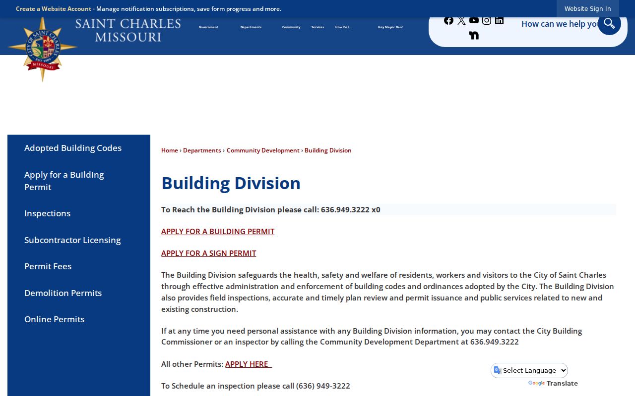
For a street record, use the City route to confirm the public permit channel, then retain the parcel and service address separately in research notes.
St. Charles Property Fraud Alerts
The county's free Property Fraud Alert service watches for an instrument recorded in the prior 48 hours that matches a chosen name or business name. An alert can provide an instrument number for follow-up at the Recorder. It does not prevent fraud, remove an instrument, authenticate title, or replace a recorded deed review. Pair an alert with the actual instrument and professional advice when a recorded transfer appears unfamiliar.
Limits of St. Charles Street Directories
A St. Charles street directory cannot show every person connected with an address. It does not create access to unlisted occupants, protected residents, motor-vehicle addresses, utility-customer information, delivery information, or informal community membership. A mailing address on an assessor card is not a household count. GIS boundaries are not a legal survey, and assessment data is not a deed or title determination.
Lawful use. Use address records for personal, lawful research and civic or family-history questions. Never use a street search to stalk, harass, intimidate, or harm another person.
Note: Keep the original URL, access date, street spelling, parcel ID, and instrument number with each St. Charles street result.